Skip to content
infrag.ai

For independent ag retailers and co-ops

Know where to send your team first.

Infrag flies your growers' fields and puts a current, high-resolution map of each one in front of your agronomists and crop advisers, with an AI Advisor that marks suspected trouble spots. You bring the agronomy. We bring the picture.

No drones to buy · No pilots to hire · No contract · First 500 acres free

Advising on orchards and other specialty crops? Know which blocks need your PCA today.

Illustrative conversation. Suspected findings are checked on the ground.

Why this is different

Imagery that isn't tied to a decision doesn't pay.

You already know that. So do the retailers in the CropLife–Purdue dealer survey.

36%

of ag retailers reporting on their drone-imagery service said it was not breaking even.

Source: 2025 CropLife Purdue University Precision Dealer Survey (opens in a new tab). 93 ag retailers serving field crops; profitability question asked in 2024 and reprinted in the 2025 report.

“UAV or drone imagery is a service area where dealers have struggled to make ends meet—possibly because much of imagery is not directly tied to an input that generates revenue.”

Source: 2025 CropLife Purdue University Precision Dealer Survey (opens in a new tab).

So Infrag is not sold as imagery, and it is not sold by the season.

What your team gets

Built around the people who carry the acres.

For independents

Sized for an independent.

You don't need a digital-ag department for this. There is no subscription, no season minimum and no multi-year agreement. You order a scan for the fields you choose and pay $1 an acre for it.

  • Nothing to buy or staff

    Infrag carries out the scan and provides the map and the tools.

  • No contract

    If it stops paying, you stop ordering.

  • One conversation to start

    A 30-minute call. Bring your agronomy lead, or come alone and bring them to the field demo.

  • One location is enough

    Start with one location and a few growers. Widen it when your own numbers say so.

The two barriers retailers name most are people and equipment.

51%

of ag retailers say it is difficult to find employees who can deliver precision services. It has been their most-cited barrier since 2021.

45%

say the cost of the equipment needed to provide precision services limits what they offer.

Source: 2025 CropLife Purdue University Precision Dealer Survey (opens in a new tab). 93 ag retailers serving field crops; share who agree or strongly agree.

Draft — sample data

Case study · Israel

From 1,140 acres to 23 places worth a walk.

Over one season in Israel's Western Galilee, a wheat and avocado grower, the field agronomist from the grower's input distributor and an independent pest scout used five Infrag scans to decide where to walk first. They marked 23 suspected areas. Seventeen were confirmed on the ground.

Draft — sample data

“It never told me what a patch was. It told me where to walk. Seventeen of the twenty-three places were worth the walk, and I would rather check six for nothing than miss one.”

Field agronomist, regional input distributornorthern Israel
Draft — sample data

“What a grower buys from us starts with our agronomist's recommendation. When the recommendation starts from a picture of the grower's own field, it is an easier conversation on both sides of the table.”

Regional manager, input distributornorthern Israel

1,140 acres

Draft — sample data

mapped over five scans, December 2025 to April 2026

Coverage

“With two scans side by side, I knew which rows to walk first.”

Independent pest scout, Western Galilee

17 of 23

Draft — sample data

suspected areas confirmed when checked on the ground

Ground truth

“From above it was one straight line of tired trees, and a straight line in an orchard is usually a pipe.”

Orchard manager, Western Galilee

4

Draft — sample data

paid scans ordered after the free first one

Repeat orders

“Now we look at the whole field first and walk to the marked places.”

Wheat and avocado grower, Western Galilee

The workflow

Who does what.

Four steps. Infrag does one of them. Your people do the ones that need judgment.

  1. Enroll fields

    YouYou choose the growers and send field locations and acres. We arrange the scan.
  2. We fly and map

    InfragInfrag carries out the scan and stitches the images into one detailed map of the whole field. Your team does not touch an aircraft.
  3. Ask and mark

    Your adviserYour agronomist or crop adviser opens the map, questions the AI Advisor and marks the areas worth a closer look.
  4. Check, then recommend

    Your adviserYour adviser walks to the marked spots, confirms what is there and makes the recommendation to the grower. That part stays yours.
Infrag
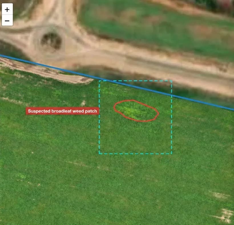
Wheat field with a suspected broadleaf weed patch outlined in red and a dashed selection box around it
Suspected patch outlined for illustration. Field imagery from an Infrag scan in Israel
Draft — sample data

One example, start to finish

Winter wheat · January scan, before the herbicide decision

What the map showed
A patch in the northern block with a different color and texture from the wheat around it. Asked about it, the AI Advisor outlined it as a suspected broadleaf weed patch and, on request, marked thirteen similar areas across the five blocks.
What the ground check found
The agronomist walked to all fourteen. Eleven were broadleaf weeds. Three were not: two were bare, stony ground and one was animal damage.
What the adviser did
The eleven confirmed patches sat in two of the five blocks. The agronomist recommended a herbicide pass on those two blocks and none on the other three. The March scan, set beside January's, showed the grower what had changed.
What it does, and what it doesn't

Clear about the line.

Your advisers answer for what they recommend. Software that overrides them costs you their trust, and theirs is the trust your growers buy.

Infrag does

  • Fly the field and build one detailed map of all of it
  • Show visible differences in the crop
  • Let the AI Advisor inspect the imagery and locate suspected issues
  • Give the location of every marked spot
  • Keep scans by date, and compare any two

Infrag does not

  • Diagnose a disease, a pest or a deficiency
  • Recommend a product or a rate
  • Replace a ground check
  • Replace your agronomist, crop adviser or PCA
  • Sign the recommendation

Suspected findings are confirmed on the ground, by your people. The recommendation carries their name, not ours.

When to scan

Scan when there's a decision coming.

A scan earns its dollar when it changes where someone walks, or what they recommend when they get there.

Row crops

  • After emergence

    Look for gaps and uneven areas before the replant conversation.

  • Before a herbicide pass

    See where the weedy patches appear to be, then check them.

  • Before a fungicide decision

    Look across the whole field for areas that stand out, and walk those first.

Orchards and specialty blocks

  • Block by block

    See a whole block on one map and mark the trees or rows that look different from their neighbors.

  • After an irrigation or fertility change

    Compare the scan before with the scan after.

Any crop

  • After a treatment

    Put two dates side by side and show the grower what changed.

  • After weather

    See the extent of visible damage across the field.

Every one of these ends the same way: your adviser checks it on the ground.

For your growers

Your advice, with a picture behind it.

With the field on screen, your adviser can show a grower the areas that were marked, what the ground check found, and how the field looked before and after the last treatment.

  • Something to show at the kitchen table, not just say.
  • A season's record for each field, scan by scan.
  • A reason to sit down with your best growers between orders.
  • Start with the growers you least want to lose.

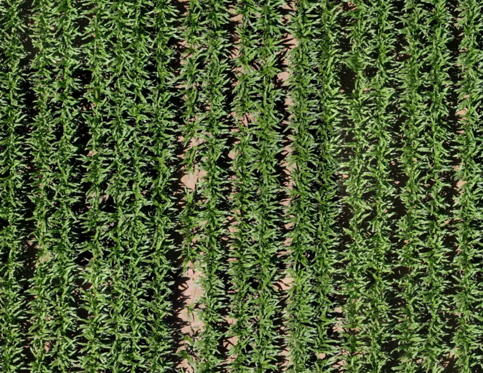
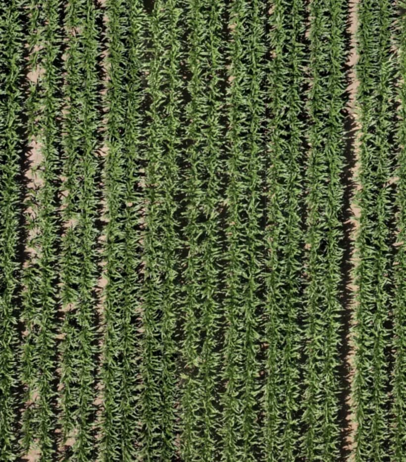
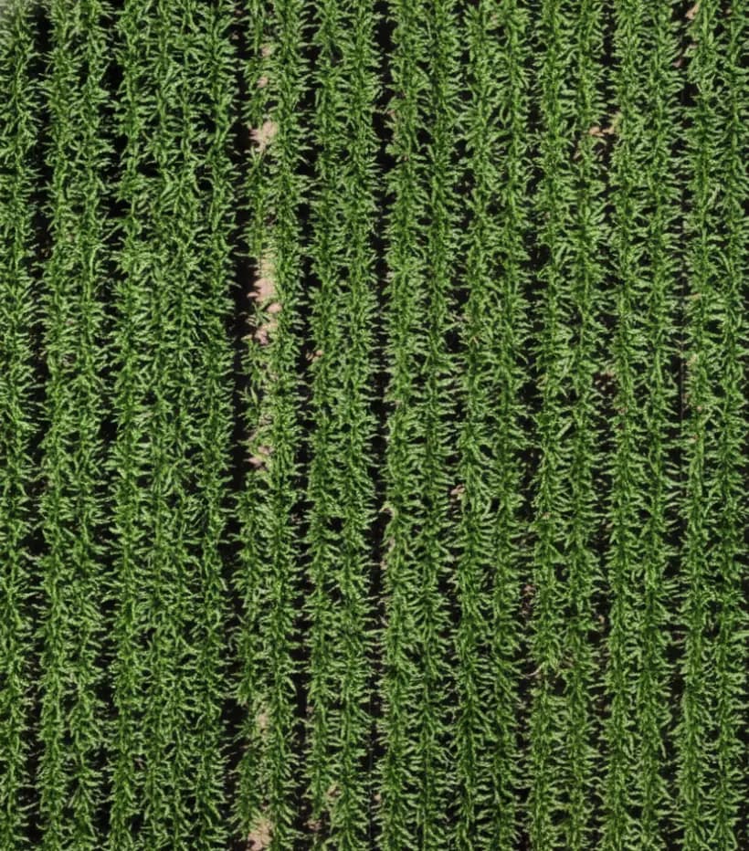
Original field imagery. Scans from 11-13-2025 and 11-27-2025.

The per-acre numbers

Run it on your own acres.

The public price is $1 per acre per scan, with a 500-acre minimum order, no contract, and the first 500 acres free. How you pass it on is yours to decide: charge for it, include it in a program, or carry it for the growers you most want to keep.

Your acres. Your numbers.

Put in what you would scan and what you would charge. The one number we fill in is our public price.

Minimum order: 500 acres.

One scan per decision: after emergence, before a pass, after a storm.

The public price.

Optional. Enter 0 if you include scans in a program.

Optional. Your own estimate for the season.

Optional. Your own figure.

Enter acres and scans to see the season.

Your cost for the seasonAcres × scans × $1.
—
Cost per acre for the season
—
Service marginWhat you charge minus what you pay. It is a cost when you include scans in a program.
—
Contribution from extra input sales
—
Net per acre
—

Your numbers, not ours. We go through them with you on the call.

Estimate at the public price of $1 per acre per scan, with a 500-acre minimum order, before the first-scan offer. Final pricing is confirmed when booking.

Partner terms are agreed on a call.

Pricing in full

Shape it with us

We are building this with independent retailers.

Our case study so far comes from Israel. In the United States we are starting with a small group of independent retailers and co-ops, and we want their agronomy teams to tell us what the product should do next. If you would rather tell a supplier what you need than be told what you get, we should talk.

From first call to first season

Five steps. You can stop at any of them.

  1. A 30-minute call

    Bring your territory, your crops and how your team scouts today.
  2. A field demo

    We scan two or three of your growers' fields, in season, and go through the maps with your advisers. Your first 500 acres are free.
  3. The per-acre numbers

    A second meeting with whoever signs: what a scan costs you, what you charge, what it leads to.
  4. A pilot

    Scoped together and sized to what can be flown on time. Terms are agreed before the first flight.
  5. One season, one or two locations

    Then you decide whether to widen it.

What to measure in a pilot

Agree what you will measure before the first flight. We suggest five things.

If the scorecard doesn't justify it, you stop. There is no contract to cancel.

MeasureHow
Time from flight to mapHours, for every scan
Suspected areas marked, and how many your advisers confirmedA count, for every field
Field timeYour advisers' own estimate, before and after
What it led toRecommendations made, passes changed, problems caught
Would you order the next scan?Yes or no

Field demos are scheduled where there is a crop in the ground. Availability and scheduling are confirmed for each location.

Book a meeting (opens in a new tab)

Already flying?

Already flying your own drones?

Bring that to the call: what you fly, what you capture and what your team does with the imagery today. We will tell you plainly what Infrag can do with it.

Data and flight operations

Questions your team will ask.

Who flies, where we fly and what the product claims are answered below. Questions about field data belong on the first call, and we would rather be asked.

Questions from retailers

Before the first call.

No. Infrag shows suspected areas and where they are. The recommendation is your adviser's, made after a ground check, and it carries their name.

The minimum order is 500 acres at $1 an acre. There is no season minimum, no subscription and no contract.

You are not alone. In the CropLife–Purdue dealer survey, 36% of retailers reporting on their drone-imagery service said it was not breaking even. Infrag is ordered one scan at a time, when a decision is coming, and what your team takes from it is a short list of located areas to check, not a color map to interpret.

Source: 2025 CropLife Purdue University Precision Dealer Survey (opens in a new tab). 93 ag retailers serving field crops; profitability question asked in 2024 and reprinted in the 2025 report.

Keep it. Infrag is ordered per scan, so it can cover the fields and the moments your season plan does not.

The AI Advisor is a conversation. An adviser asks what is happening in an area, and the Advisor inspects the imagery and marks suspected areas on the map. The map tools are the ones the names suggest: zoom, measure, mark and compare.

No. It tells your team where to walk first. A person still checks every suspected area on the ground.

From row crops to orchards. Tell us what your growers have in the ground and where, and we confirm what we can scan and when.

Yes. Scans are on demand, with no contract or commitment. Scheduling depends on field location and operating conditions.

There is no contract to cancel. You stop ordering scans.

With a 30-minute call. After that comes a field demo on two or three of your growers' fields, then a per-acre look at the numbers, then a pilot at one or two locations if it adds up. You can stop at any step.

Bring one location. We'll bring the map.

Thirty minutes with the Infrag team to see whether a field demo makes sense.